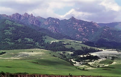
Land Armenia is one of the most beautiful countries. Diverse nature creates incredible views of mountains and valleys.Republic occupies about 29,800 sq km of the northeastern portion of the Armenian Highland.
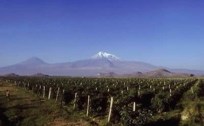
The highest peak of Armeian Plateau is Masis ( 5,156 m).Mount Aragats is the highest point in the republic, reaching a height of 4,090 m (13,419 ft).
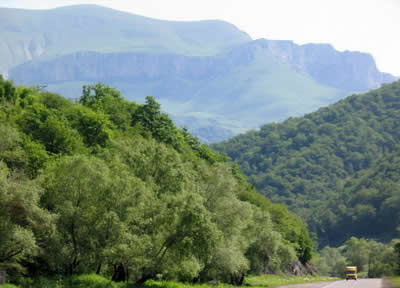
The arched system of mountain ridges consists of two, and in the central part of three and four, rows of parallel and converging mountain chains. The central ridges of the Lesser Caucasus are composed of various sedimentary and volcanogenic Mesozoic rocks, while the outer chains are formed of Tertiary marine sediments. All these mountain systems were first bent into folds and later broken up by transverse and longitudinal faults, for which reason they now form folded and faulted structures slightly inclined to the north-east and sharply breaking towards the Highland. The Somkhet range or Virkahaiots stretches along the Armenian-Georgian border.
West of the Lori plateau is the higher, though smaller, Ashotsk plateau (1,800-2,000 m). Between them rises the longitudinal Javakhk volcanic range. South of the Ashotsk plateau stretches one of the largest and most fertile Armenian plains the Shirak plateau (1,400-1,500 m high) divided by the international boundary along the Akhuryan river.
South of Sevan and the Vardenis mountains is the historic Syunik region which unites the Vaik and Syunik (Zangezur) mountain regions.
The soils, vegetation and fauna of Armenia are closely interconnected. Five principal natural zones have formed in Armenia: semi-desert with elements of the desert, steppe, forest, alpine and mountain-tundra; these zones are samples of nearly all the zones of the CIS, from the deserts of Central Asia to the Arctic Ocean. Armenia has rich deposits of copper, molybdenum, complex ores, including iron ore.
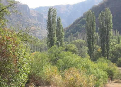
The steppe zone is Armenia 's granary. It is quite well cultivated, especially since in many places the land can be tilled without irrigation. This is the main zone for growing grain crops, potatoes, tobacco, cabbage, etc. During the last few decades beets and fruit have been successfully grown in many steppe areas (the Shirak plateau, the Pambak valley) and grapes in the Talin district. Orchards and vineyards have also been appearing on the western slopes of the Gegham range, at the foothills in the Kotaik, Artashat and Vedi districts. The greater part of the forests are located in the north-east of the Republic where they cover 28-30 per cent of the territory, taking up the steep slopes of numerous mountains and canyons. The upper fringe of the forests reaches an elevation of 1,900-2,000 m above sea level.The second large tracts of forests are located in Zangezur where they cover more than 20 per cent of the territory and reach an elevation of 2,200-2,400 m. The rest of Armenia is almost devoid of forests. They occur only as small islands on the eastern slopes of the Aragats and Tsakhkunyats ranges and on the southwestern spurs of the Gegham mountains.
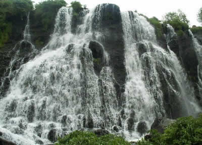
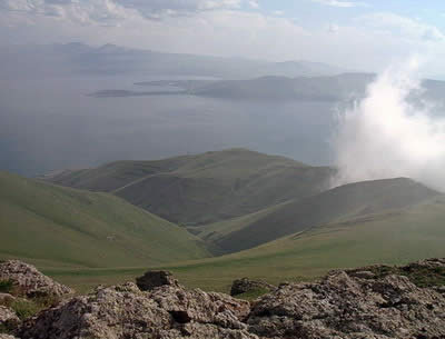
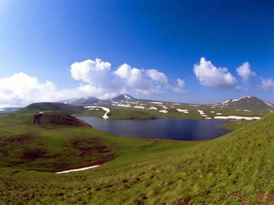
Armenia is a landlocked country. The republic contains many mountain lakes, the largest of which is Lake Sevan , located in the northeast. Lake Sevan is the largest lake in the South Caucasus and one of the largest high-elevation lakes in the world. It is also a popular resort area.
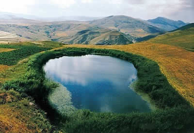
Armenia is covered with a dense network of rivers and streams albeit very large ones. More than 300 of the rivers are 10 km long or longer. Although many rivers flow into Lake Sevan, the main outlet is the Hrazdan River, which flows south to join the Aras (known in Armenia as the Arax) River, Armenia's largest and longest river.
The main railways and highways of the Armenia run along the valleys of the Debed, Aghstev, Vorotan, Arax and other rivers.
Because of the complexity of the relief, climate and vegetation the Republic has a rich fauna which includes more than 450 species of vertebrates - 70 species of mammals, 300 of birds (more than 100 of these are wintering species), 40 of reptiles (some 20 species of snakes), 23 of fish and 5 of amphibians. There are almost 10,000 species of insects and more than 1,000 species of other invertebrates. Many of these are endemic
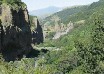
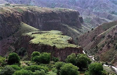
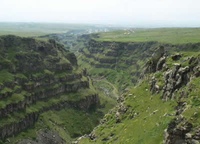
The territory of Armenia is a geological museum where we can find samples of nearly every type of rock that forms the crust of our planet . Many wild places in Armenia are untouched and are perfect for exploration and research.
|
|